
Aerial photographs
High-resolution images and repeatable progress photography from agreed viewpoints, organised into dated image sets.
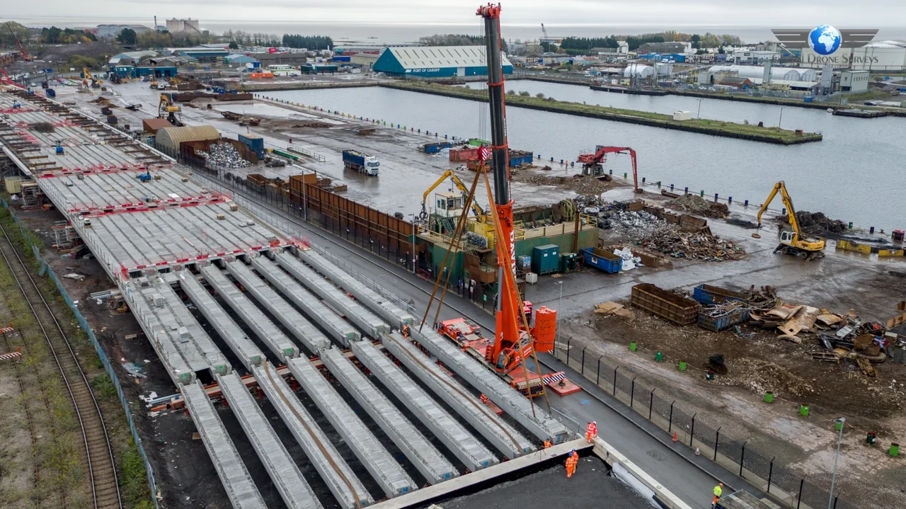
UK CONSTRUCTION / PROGRESS MONITORING
See how your project moves forward. Scheduled drone overflights create a consistent visual record of your construction site, with repeatable photography and video for clear, confident project updates.
Plan your progress flights ↗01 / YOUR PROGRAMME. YOUR SCHEDULE.
Choose the frequency that fits your build and reporting cycle. Construction site drone surveys bring site-wide context into meetings, helping teams review visible progress without gathering every update in person.
Flight dates are agreed with your team and remain subject to weather, airspace permissions and safe operating conditions.
Our team has supported a number of blue-chip companies and major organisations across the UK with repeatable aerial imagery, construction progress monitoring and project documentation.
02 / HOW THE SERVICE WORKS
Define the project questions, reporting audience and preferred flight schedule.
Review the site boundary, access, airspace and required permissions, then define the waypoint mission.
Agree camera positions, altitudes, preset angles and the images or video sequences you need.
Coordinate with your site team and capture the agreed views when conditions allow.
Process the imagery and quality-check coverage, clarity and consistency between visits.
Supply images, videos or progress packs in the agreed format for your reporting cycle.
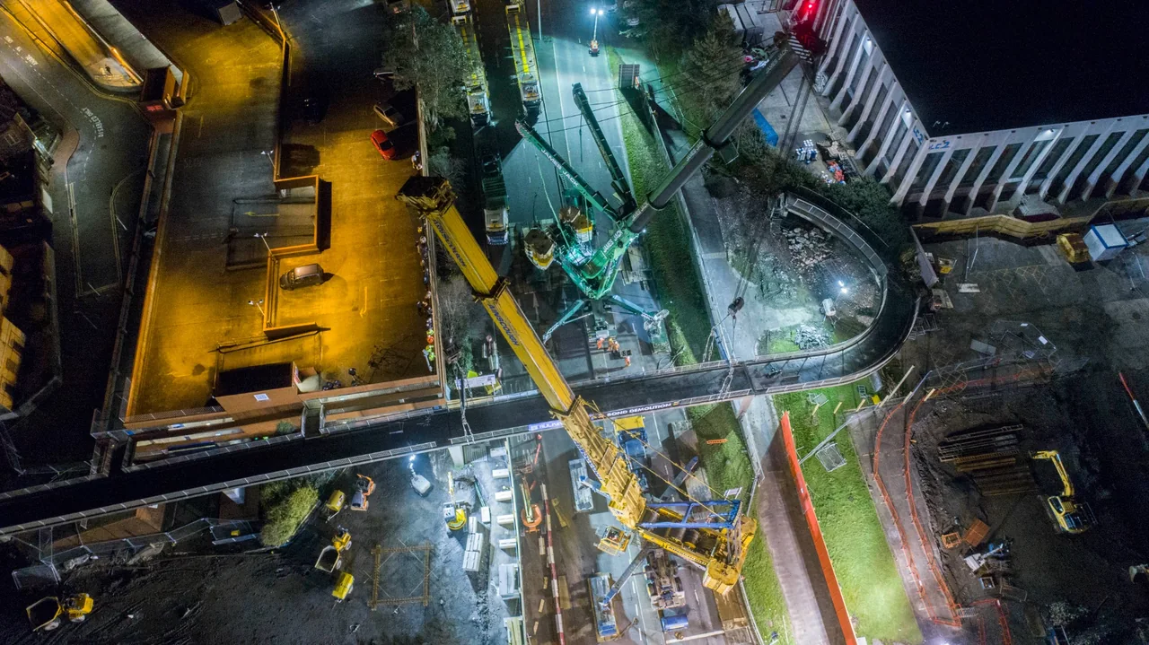
03 / REPEATABLE WAYPOINT MISSIONS
We establish an agreed waypoint mission over your building site, using consistent flight paths, camera positions, altitudes and preset camera angles wherever practical. Repeating this mission weekly, monthly or at milestones makes one visit easier to compare with the next.
Repeatable drone imagery gives your team a stable visual reference. New cranes, structures, site restrictions and weather are reviewed before every flight; any necessary changes to the mission are explained so comparisons remain meaningful.
04 / PHOTOGRAPHY, VIDEO & RECORDS
High-resolution images and repeatable progress photography from agreed viewpoints, organised into dated image sets.
Short progress videos and before-and-after comparisons to show visible changes across successive visits.
Selected image sets for stakeholder reports, time-based project documentation and project archives. Optional annotations or presentation-ready outputs can be included.
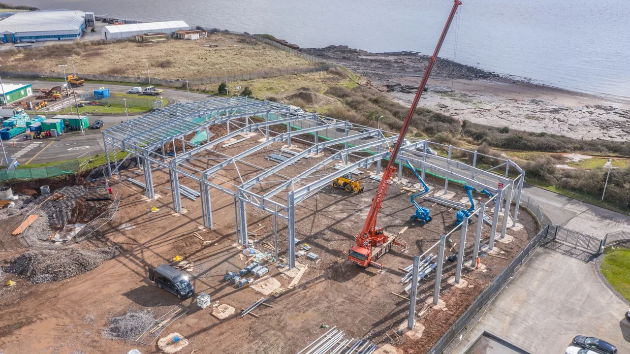
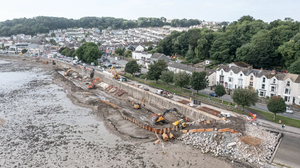
05 / FROM SITE TO STAKEHOLDER
Supplement client and stakeholder updates with a clear view of completed and ongoing activity. Give remote teams shared visual context for discussion.
Support contractor coordination and site management. Review visible progress alongside the expected programme and flag changes for your team to investigate.
Use agreed imagery in project communications and marketing, retain a visual construction record, and support internal reviews and handover documentation.
Spend less time gathering separate site updates.
Reduce unnecessary travel where a visual update is sufficient.
Show work areas in their wider site context.
Compare dated images from agreed viewpoints.
Spot potential deviations or anomalies for closer review.
Aerial construction monitoring supports your existing project management, surveying and inspection processes. Images can highlight visible changes and areas of concern, but cannot identify every defect, reveal concealed work or certify completion. Specialist assessment and site investigation remain essential where required.
06 / TWO COMPLEMENTARY VIEWS
Flexible, repeatable aerial views across the whole site at agreed intervals. Useful for understanding layout, external works and the relationship between different work areas.
Regular photographs from one or more fixed positions over weeks or months. It records activity between drone visits and can create a long-duration visual sequence; it does not necessarily provide continuous live video.
Use either service independently, or combine both for a wider view of your programme.
Construction time-lapse monitoring ↗07 / PROFESSIONAL DELIVERY
Our approach is professional and safety-led, with operations planned to comply with applicable UK drone requirements. Pre-flight planning, risk assessment, airspace review and appropriate permissions shape each visit.
We coordinate with your site team on inductions, work fronts, plant movements and safe operating procedures. Flight feasibility is reviewed as the site changes.
We agree authorised recipients, delivery methods and any confidentiality requirements before capture. Secure handling, access and retention arrangements are discussed around your project needs.
For measured outputs, explore mapping and 3D modelling. For targeted condition records, see roof and building inspections or industrial and infrastructure drone inspections.
PROJECT EXPERIENCE
Swansea / Central Phase One
24 months of monitoring
Cardiff, South Wales / Construction progress monitoring
£27.3m infrastructure project · Monthly reporting brief
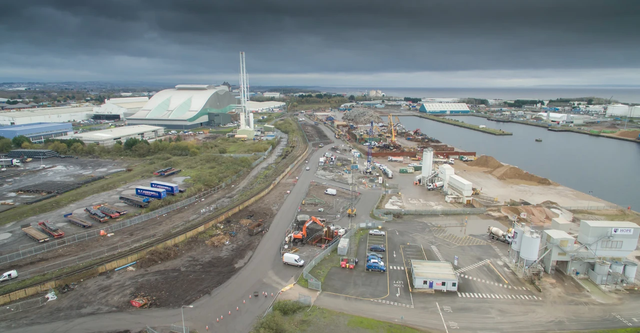 Cardiff and South Wales drone surveys
08 / USEFUL ANSWERS
Practical answers for UK construction teams.
Choose weekly, fortnightly or monthly visits, key project milestones or a bespoke schedule. Dates are coordinated with your programme and remain subject to suitable weather, airspace permissions and safe site conditions.
Yes. We plan an agreed waypoint mission with consistent routes, camera positions, altitudes and preset camera angles wherever practical. Each visit is reviewed for new cranes, structures and restrictions; safety may require adjustments, which we explain when comparing the results.
Yes. Selected photographs, short videos and optional annotated or presentation-ready outputs can support client briefings and progress meetings. We agree the audience, image selection and format so the material fits your reporting process.
Yes. Monitoring can run from the initial site baseline through successive phases and handover. We agree the visit schedule, image archive and any changes needed as the build progresses or the programme is extended.
Drone visits provide flexible aerial views across the site at agreed intervals. Fixed-camera time-lapse records photographs regularly from stable positions over longer periods, including between drone visits. The two services can be used separately or together; time-lapse is not necessarily continuous live video.
Yes. The brief can include high-resolution aerial photographs, short progress videos, repeatable image sets and before-and-after comparisons. Editing, annotations and reporting requirements are agreed before capture.
Where safe and feasible, yes. We coordinate with the site team, assess risks and airspace, and agree operating areas and suitable windows. Moving plant, people, cranes and changing work fronts influence each flight plan.
Global Drone Surveys supports construction projects across England, Wales, Scotland and Northern Ireland, subject to site feasibility, permissions and scheduling. Send the site postcode and programme dates for an initial discussion.
Delivery depends on the volume of imagery, video editing and the agreed reporting package. We confirm a turnaround at quotation stage and can discuss your meeting dates so capture and delivery support your reporting cycle.
Yes. Overflights can be planned around milestones such as groundworks, structural progress, roof completion or handover. Give us advance notice of the programme and any changes so we can coordinate access and assess flight feasibility.
YOUR NEXT PROJECT
Tell us your site location, preferred flight frequency, required outputs and project timeline. We’ll help define a practical monitoring schedule and reporting package.